Where are the hanging bridges located?
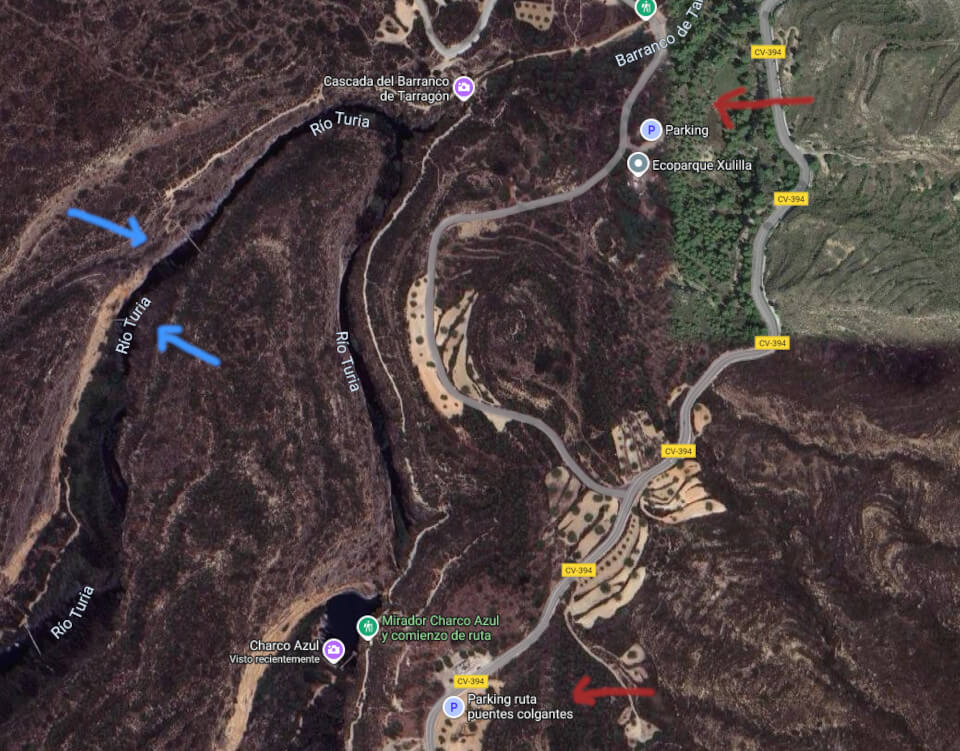
The Chulilla hanging bridges route or pantaneros route begins in the area known as los calderones, located north of the Valencian town of Chulilla.
If you are coming from Losa del Obispo, you will see cars parked on the left side where there is a parking lot about 1 km before reaching the town when a steep climb to the “altico” begins. If you are coming from Chulilla, once past the climb of the “altico”, you will see the same parking lot and the start of the hanging bridges route.
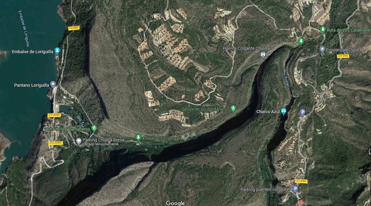
Some people do not want to wear out their shoes and park on the Losa riverbed where it meets the road that goes to the Loriguilla reservoir.
Another way to access the route is upstream from the Loriguilla reservoir and go down until completing the journey.
There is another access, but it is much more complicated and that would be enough to write an entire route.
Due to the large influx of public, especially on holidays, a fee of one euro per person was introduced, except for those registered in Chulilla.
It is necessary to respect the environment, and sadly many people are not used to not interacting with it. Although these are isolated cases, such a large number of hikers always leads to an increase in litter deposited in the area. The Chulilla Town Hall and its tourist office can offer direct information on this and other matters by calling 961657001 and emailing info@chulilla.es
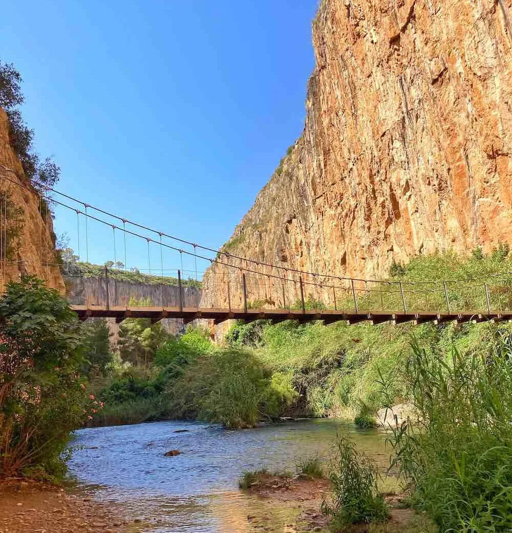
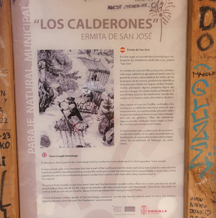
The hanging bridges route or pantaneros path originates from the workers who stayed in Chulilla and went to work on the construction of the Loriguilla reservoir. The area between Chulilla and Loriguilla is not exactly flat, as you can see. It was necessary to take a long detour to go and return. To improve working conditions, the construction of several bridges was considered. One fixed bridge closer to the dam and one hanging bridge closer to Chulilla.
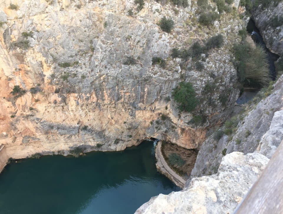
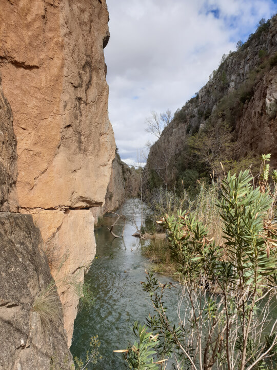
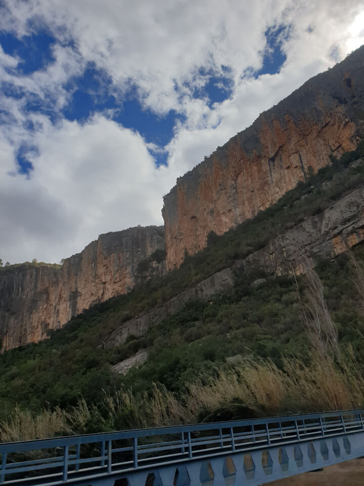
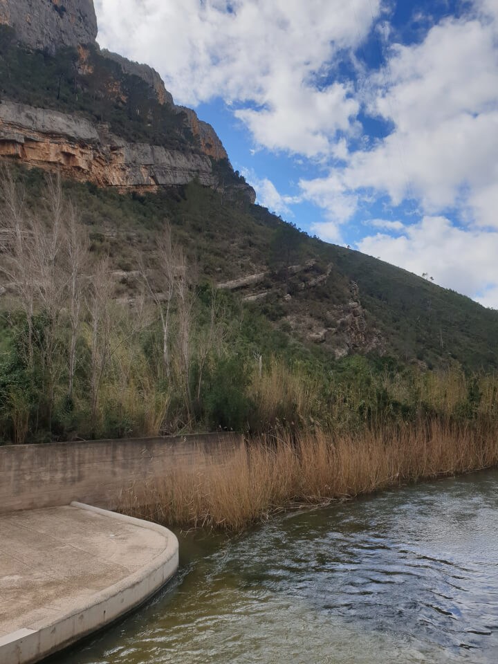
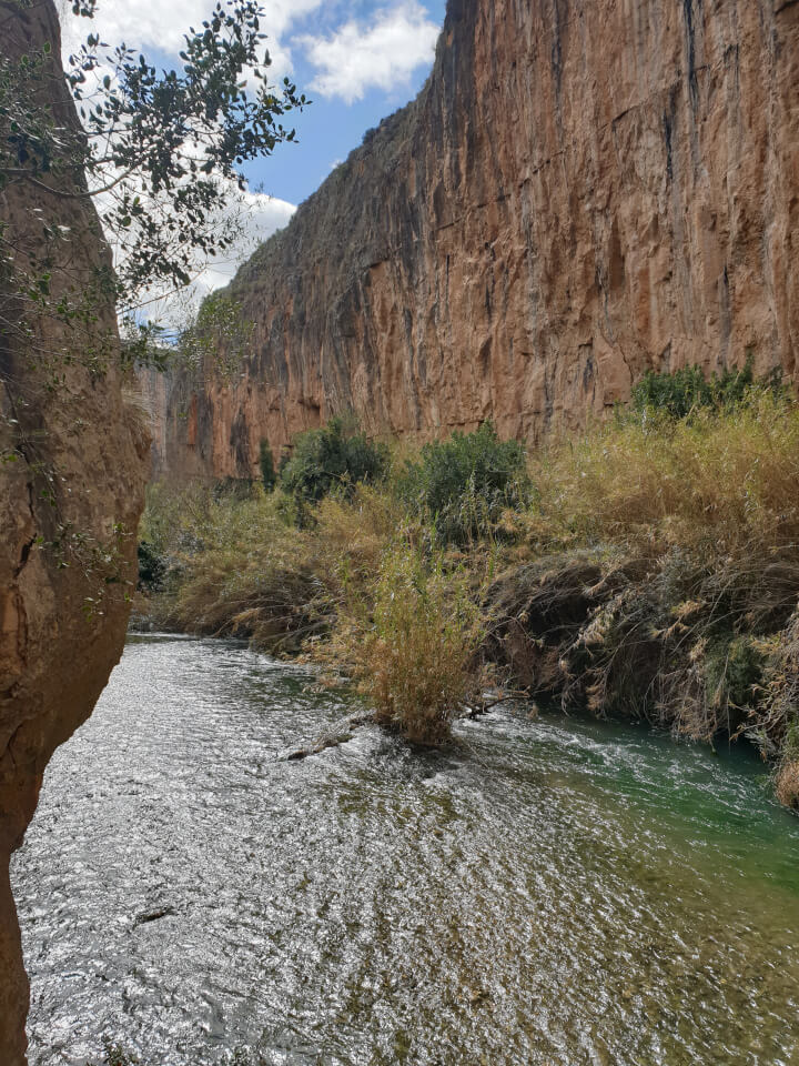
The Turia River has formed these wonderful canyons through which its waters pass over millennia. Thus, from time to time, there is a flood that ends up transforming the territory. In the great flood of 1957 that ended up flooding the city of Valencia, the fixed bridge was also swept away. I have no data on the hanging bridge. I would say that due to disuse, it would gradually fall apart. In the end, only a steel cable remained that connected to the other side right where the first bridge is now located. Someone very daring could cross to the other side as the cable seemed to be in good condition. I myself was considering that option. I didn’t do it, and I’m still alive.
When the town hall rebuilt the bridges, they used new cables. Do not fear. The old cable that had remained standing for more than 50 years was discarded.
The gorges of the Turia River and los calderones are famous for the great height reached at some points with respect to the upper Turia River (Guadalaviar), exceeding 100 meters in many places, but the highest bridge is only 15 meters above the river.
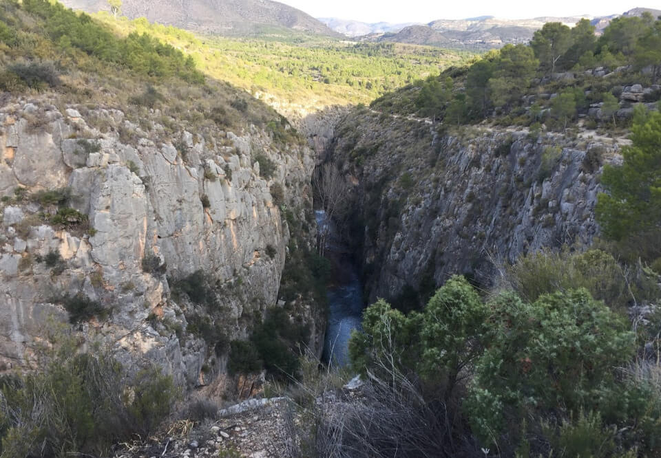
The Turia canyon right on the pantaneros route is an environment that was previously very isolated, and this was exploited by the fauna as a refuge from humans. I myself saw a golden eagle in those cliffs. I don’t know if this type of fauna still lives there. What there are are trout and otters, which are difficult to see. There are also many climbers who come from numerous European countries.
This hiking route is especially beautiful and is currently one of the most visited in the Valencian Community.
How long is the hanging bridges route?
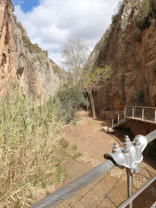
It is a simple route that can be done as a family. If you feel like walking a few more kilometers, you can do a circular route that goes around behind Chulilla, going up to the Loriguilla reservoir in the direction of the Vallfiguera ravine. You can turn left to get back to Chulilla. This circular route already requires some planning (water, food, footwear, etc.) as it is 16 km and takes approximately between 4 and 6 hours depending on the pace. Another option is to continue walking towards the reservoir and return from there, which would only take about 2 or 3 hours.
The vast majority of people do not do the circular route but spend some time in the area of the bridges and return to the car. Doing this very short stretch takes very little time. Around one hour.
How many kilometers is the hanging bridges route?
The Chulilla hanging bridges route is approximately 10 kilometers long. The circular route is about 16km. If you only go to the first bridge and park as close as possible to los calderones and not in the town, the distance would be very short, about 2 or 3 km.
Can you swim on the route?
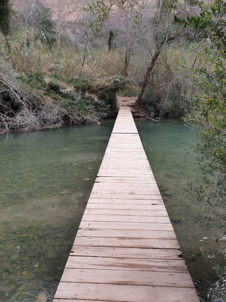
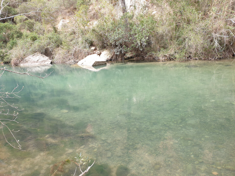
Of course, many people wet their feet at the second bridge. It is not a swimming area and it is not deep. If you want to soak a little more, you will have to advance further on the route and almost reach the reservoir. In that area, there are some backwaters where you can do more water activities. In any case, the main swimming areas of Chulilla are the Charco Azul, the Remanso de las Mulas, and the Peña Judía.
The water coming out of the base of the dam is almost the same temperature all year round because it is usually very cold in summer and warm in winter. It has a similar temperature to the beaches of the Cantabrian Sea. If you are sensitive to the cold, don’t go in.
At the end of the route, don’t forget to go to the town’s bakery and buy a reguiño, mantecados, almond torticas, cocotecs,… and in the butcher shop, the rice sausages (better than those from Burgos). If you go to a restaurant, the most typical dish is olla de berzas (cabbage stew) and ask for a generous portion of rin-ran (a delight)…
Do you have to pay a fee?
Yes, every day of the year unless you are registered in Chulilla. The cost is one euro and is used to pay for the maintenance and improvement of access to the route.