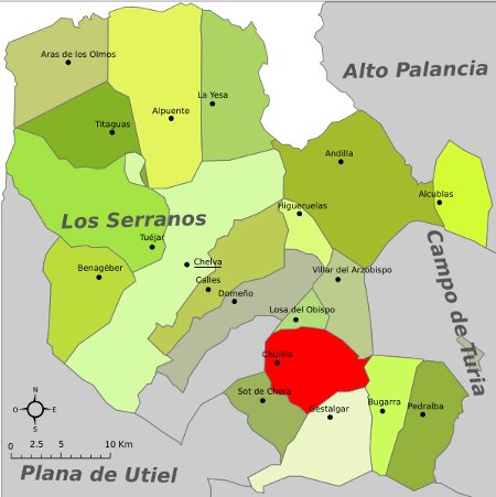
Chulilla is located in the province of Valencia (Spain) in the northwest area and belongs to the region of La Serranía officially called “Los Serranos”. It limits to the north with Losa del Obispo and with the Villar del Arzobispo, to the west with the abandoned town of Loriguilla, to the south with Sot de Chera, which is colloquially called “Sote”, and to the south and east with Gestalgar.
It is located less than 60 km from the provincial capital and the altitude of the town center slightly exceeds 300 m, although the castle is located 400 m high. The municipality has an extension that exceeds 60 km.
Although the maximum level barely exceeds 600 m (the serratilla), its orographic profile is markedly mountainous, with a large number of ramblas and ravines, which makes this area one of the most intricate of the Iberian mountains.
It has a population of about 700 inhabitants, although this number increases considerably in summer, when many descendants of the town, who once had to emigrate, return to spend the holidays.
The most advisable option is to use the road that leaves Valencia in the direction of Ademuz, which in its first kilometers is part of the Líria highway.
Another option that very few people use is to go through Requena. It is a road with many curves and not highly recommended, although many improvements have been made in recent years. As an advantage you can enjoy an impressive landscape.
Snow in ChulillaHow many inhabitants does Chulilla have?
The number of inhabitants in Chulilla in 2018 is 615. There has been a clear decrease in population in recent years. Not long ago, the municipality had around 900 inhabitants.
What is the name of the river that passes through Chulilla?
The main river that passes through Chulilla is the Turia River, which in the Teruel area is called Guadalaviar, meaning “white river” in Arabic. It originates in the Montes Universales (a mountain range located on the border between Teruel and Cuenca) where other important rivers of the Iberian Peninsula also originate, such as the Tajo, Júcar, and Cabriel. The Turia River runs 280 km until it reaches the sea in the city of Valencia.
However, the Turia River is not the only river that passes through Chulilla. The Sote or Reatillo River, which originates in Chelva and passes through Chera and Sot de Chera, flows into the Turia River, forming very intricate landscapes of crystal clear waters.
Where can you swim in the Turia River?
In Chulilla, there are several still waters where you can soak and swim.
- The “Remanso de las mulas”: located in the southern area of the town, it is a shady and very leafy place surrounded by orchards. It is accessed by going down from the Barranquillo area.
- The “Remanso de la peña judía”: it is to the north of the town, more or less close to the route towards the “Charco Azul”. It is quite small but you can swim against the current and see how long you can hold up. The water here is very cold.
- The “Charco Azul”: with depths of up to 5 meters, it is an ideal place for swimming if it weren’t for its low temperature. The water from the Loriguilla reservoir comes out at about 15 degrees Celsius all year round, so if you go in winter, you might find it warm. At the height of the “charco” (toll in Valencian), the temperature is 17-18 degrees Celsius in summer, similar to that of the Cantabrian Sea.
What to do in the region of Los Serranos?
The region of Los Serranos in Valencia offers a wide variety of activities to do, both for nature lovers and those interested in culture and history. Some of the things you can do in the region include:
Hiking: The region of Los Serranos has a large number of trails and routes to walk, where you can enjoy impressive landscapes and native flora and fauna. The GR7 passes through Andilla and Chelva.
Rural tourism: The region has numerous rural houses and tourist accommodations where you can enjoy the tranquility of the environment and local gastronomy. We highlight the old Balneario de Chulilla and Verche.
Visiting historic towns: In the region, you can visit several towns with important historical and cultural heritage, such as Chelva with its Jewish and Muslim neighborhoods, Alpuente with its own aldeas from the time of the Taifas, Tuejar, Titaguas or La Yesa.
Adventure sports: There are specialized companies in the region that offer activities such as rafting, canyoning, climbing, or ziplining. The Bercolón ravine in Tuejar and the Turia canyon are two privileged places for these practices.
Birdwatching: The region is a privileged place for birdwatching: eagles, vultures, owls, kingfishers, …
Visiting museums: In some towns in the region, there are museums dedicated to local culture and history, such as the Ethnological Museum of Chelva or the Honey Museum of Tuejar.
Tasting local gastronomy: The region has a rich gastronomy, with dishes such as olla churra, serrano gazpacho, black truffle, or homemade sausages.
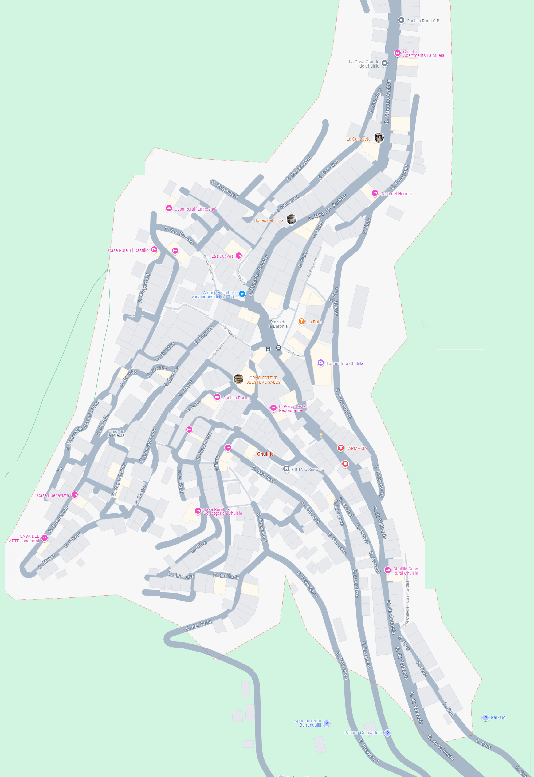
Map of Chulilla

